
The Pollution Control Department’s regional offices in the upper North, the hotbed of forest fires and PM2.5, have been reporting PM2.5 levels beyond the safety threshold for nearly a week, suggesting a crisis period emerging just ahead of the rainy season
The PCD’s Regional Office 1, responsible for Chiang Rai, Chiang Mai, Lamphun, and Mae Hong Son provinces, has issued a critical warning against the PM2.5 levels that are beyond the safety threshold set at 75.1 micrograms per cubic metre (μg/m3), considered to be hazardous for health, and that continues more than three consecutive days since May 2, suggesting the period of a crisis as addressed by the government.
Its Regional Office 2 counterpart, responsible for the lower provinces of Lampang, Phrae, Nan, and Phayao, has also issued a similar warning.
Under the new protocol this year, a crisis period of PM2.5 is divided into two levels. The first level is set at PM2.5 beyond 75.1 μg/m3 for three consecutive days. The second or maximum level is set at PM2.5 beyond 150 μg/m3 for five straight days onwards.
This will help concerned authorities to implement the so-called emergency measures to address the crisis until it is relieved in their responsible areas. They include the closure of protected forests and stringent law enforcement against forest encroachers and firesetters, Work from Home implementation, as well as other public health measures to mitigate impacts on people’s health.


Provincial emergency war rooms chaired by Governors are also set up to command the situation through these measures once the crisis arrives. The new hotspot reduction target has been set at 50% of last year’s records in 10 prime protected forests and forest reserves.
On May 1, the PCD itself also issued a warning of the hazardous level of PM2.5 dust particles for eight provinces in the North and another two provinces in the Northeast. It cited brunings of forests (N), cornfields (N), and rice fields (NE) as the prime causes of the incident. While 1,480 hotspots were detected in the forests, over 400 (409) hotspots were detected in cornfields, and 331 more in rice fields respectively.
The department additionally cited the high number of hotspots in neighbouring countries, saying that over 4,700 (4,791) hotspots were detected in Laos, and 1,243 more in Myanmar.
The last wave of wildfires
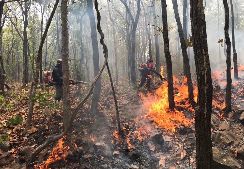
The rise in hotspots in the North is seen as the last wave of wildfires before the season is about to enter a wet period of the rainy season, projected to be in the middle of this month. As observed by air pollution monitoring experts including the popular knowledge-sharing FB page, Fah Foon, the fire season in the North this year has been delayed around one month, compared to last year. (Read: Almost all national parks declared closed against the rise of PM2.5 haze)
While the peak last year was in March, it’s apparently the peak this year has just arrived. Based on the observations, the first wave of the fires in the forests in the North started around the first week of March before they were dispersed by rains, and they sprung up again in early April.
As observed by Fah Foon FB page, the most challenging forests of Mae Ping, Om Koi, and Mae Tuen in Chiang Mai and Lamphun, and of Salween, known as the Big Fish, started to feel the pinch by early April, when regular fire setters showed up in the areas and lit the fires for their conventional livelihoods of forest product collection and wildlife hunting. At Mae Ping National Park alone, nearly 150,000 rai of its forest area was burned down as a result, according to the page.
As of April 22, the Department of National Parks, Wildlife and Plant Conservation (DNP) reported 41,874 hotspots were detected in protected forests under its supervision nationwide, or a 39% reduction compared to last year’s statistics. 135 protected forests were closed against fire setting attempts and 140 people were charged in relation to the fire setting in the forests.
The statistics last year showed that hotspots from all sources nationwide were recorded at around 172,000. Of this number, 120,000, or 69%, occurred in forest areas; 70,000 in protected areas of national parks and wildlife sanctuaries and the rest in forest reserves. Of 70,000, over 52,000 occurred in the protected forests in the North, with Chiang Mai’s hitting the highest record at 7,245 hotspots.


l The statistics showing PM2.5 levels in 17 northern provinces through the whole months of March and April. Credit: PCD
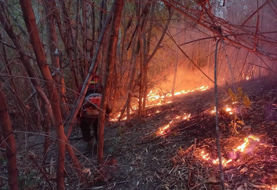
The second wave of the fires was put out by the rains during the Song Kran holidays before the last wave of the fires started around late April. The page’s manager concluded after reading graphs and statistics that there is a correlation between the fire setting and the rain intervals in the Northern forests.
Alongside, the number of hotspots in the neighbouring countries also rose during the same period. On April 29, Laos saw over 6,300 (6,335) hotspots, while Thailand’s was beyond the critical number of 2,000 hotspots (2,158). This is considered beyond control by concerned officials if occurring at the same time. The last wave of the fires has sent the records of PM2.5 in the region beyond 200 μg/m3. The highest concentration level of PM2.5 was measured in Chiang Khong district in Chaing Rai province on May 2, at 223 μg/m3.
But as the weather forecast has projected that the country will be going through a series of thunderstorms in the next few days, the provincial war rooms have started to lower their guards, issuing an order to allow controlled burning throughout this month despite the PM2.5 haze has reached its critical level in several areas in the provinces, especially Chiang Rai and Chiang Mai.


l The map shows the locations of fires detected on March 16 by VIIRS and the natural-colour satellite image shows a hazy day in Thailand during the region’s 2024 fire season. Credit: NASA
Grappling with Thailand’s Seasonal Haze: NASA
In March, NASA, in collaboration with GISTDA and other institutions in the region, conducted an international field campaign known as ASIA-AQ or Airborne and Satellite Investigation of Asian Air Quality, to take a close look at the PM2.5 haze in Thailand.
According to NASA, each year in January and February, satellites begin to detect waves of smoke and fire in Southeast Asia, particularly in highland forests in Cambodia, Laos, Myanmar, and Thailand. Fire activity continues to increase through March and April, reaches a peak during the height of the dry season, and then fades in May with the start of the rainy season.
Individual fires are usually small and short-lived, but they are often so numerous that smoke, along with air pollution from rural and urban areas, mixes to produce thick layers of haze that blanket the landscape, NASA noted. Such hazes contain mixtures of small airborne particles or aerosols and gaseous pollutants such as nitrogen dioxide, sulfur dioxide, carbon monoxide, and ozone that degrade air quality and have harmful health effects, the space observation organisation noted.
During the first two weeks of March 2024, NASA’s DC-8 and Gulfstream III aircraft flew several flights over Chiang Mai, Bangkok, and rural areas surrounding the cities to sample air quality with several sensors. At the same time, satellites observed the haze from above.
ASIA-AQ’s principal investigator James Crawford said the goal of the mission was to take as many simultaneous measurements of pollutants as possible from the ground, air, and space. The team would then use the data to refine models of how the region’s haze forms, evolves chemically over time, and moves throughout the region.


l DC-8 during the mission in mid-March. Credit: NASA
Fires, most of them lit intentionally, are a major contributor to the haze, NASA observed. One of the main reasons, it noted, is agriculture, either to clear forests for planting or to burn post-harvest crop stubble.
Danny Marks, a Dublin City University geographer, noted; “Maize, which is primarily used for animal feeds, is the crop burned the most.” It’s also common for people to start forest fires to aid in the collection of mushrooms and other forest products and to make it easier to hunt game, he said. Subsistence farmers sometimes practice swidden agriculture, a technique that involves periodically cutting down trees and shrubs, letting the wood dry out for a few months, and then burning it to clear space for crops.
Mary Mostafanezhad, a geographer at the University of Hawaii who conducts research in Chiang Mai and has studied how the region’s seasonal fires are perceived, says there has been heightened interest in the issue in recent years. The haze has exposed complex rifts between rural populations in the highlands and urban populations, as well as between various economic interest groups and ethnic communities, about the activities that are most responsible for the haze, how dangerous it is, and what can be done about it.
However, researchers say that the proportion of the haze that comes from urban sources, such as emissions from the transportation or industrial sectors, compared to fires or other rural sources of pollution, is unclear. Understanding the role of geographical features and meteorological factors, as well as the interactions between various pollutants, in controlling the distribution of haze remains a challenge. Chiang Mai, for instance, lies within a basin prone to temperature inversions that can prevent winds from dispersing air pollution, NASA noted.
NASA teams are currently working with partners in the region and the USAID-NASA SERVIR program to develop tools designed to inform people about haze and smoke during the fire season. SERVIR Southeast Asia has worked with the Royal Thai Government’s Pollution Control Department (PCD) to develop the Mekong Air Quality Explorer tool, NASA said.
SERVIR Southeast Asia’s geospatial manager Aekkapol Aekakkararungroj said this decision support tool combines satellite data from NASA with ground station data and machine-learning analytics to enable monitoring and forecasting of air quality in Thailand.
Another tool called Smoke Watch developed with assistance from the SERVIR program, can port timely VIIRS observations of fires into a real-time warning system that firefighters have used to pinpoint fires and fight them as quickly as possible, explained the application’s developer Nion Sirimongkollertkul, an environmental engineer at the Rajamangala University of Technology Lanna Chiangrai.
A remote sensing expert with the Upper ASEAN Wildland Fire Special Research Unit at Kasetsart University, Veerachai Tanpipat, who has written about monitoring fires in Thailand with satellites, said there are some indications from satellite observations that there has been a slight downward trend in fire activity in Thailand in recent decades, but it’s a modest decrease, not enough for most people to notice.
“We still see many poor air quality days, and we don’t yet have a practical prescribed burning system in place. Meanwhile, we have seen increasing numbers of low-cost sensors in cities, so people in the area are more aware of the problem now than ever before,” he said.
After scientists return from the ASIA-AQ campaign in April, NASA said they will continue analyzing data collected from sensors on the aircraft as well as from several satellite sensors including VIIRS (Visible Infrared Imaging Radiometer Suite) as well as participating ground-based sensor networks.
In April, the researchers from Chiang Mai Univesity’s Faculty of Science also released their findings of the study on the proportion of the pollution sources of PM2.5. It showed significantly that the prime source of the PM2.5 haze in Chiang Mai during the haze season is biomass burning (51%), followed by the secondary particles from locations as far as the border and India, while the particles off-season are from traffic.
“The study shows that the PM2.5 haze during the season is clearly from biomass burning and cross-border pollution. So, it’s necessary to prioritise mitigation measures in different periods of time,” said the researchers.
The health impacts
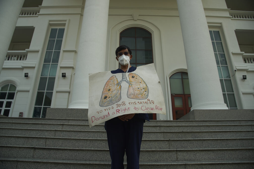
To mitigate the health impacts of PM2.5 haze, the Ministry of Public Health this year has stepped up monitoring and measures including focusing more on target groups who are prone to lung cancer.
The ministry has come up with a pilot project, Lanna CA Screening, by using low-dose CT scans on risk groups, which it said, have around 1.8 million people in total. They are people aged 50 years and over, who have lived in the risk areas for more than 20 years, have genetic heredity, and are heavy smokers of 30 packs of cigarettes a year.
As revealed by Assoc. Prof. Chalerm Liewsisakul of Chiang Mai University’s Faculty of Medicine, the number of lung disease and respiratory illness cases in the region has increased in correlation with the PM2.5 haze, which has worsened over the last ten years. The studies by the faculty found a correlation between PM2.5 levels and mortality rates, with a 1.6% increase in deaths for every 10 µg/m³ rise in PM2.5.
The studies show a higher incidence of lung cancer among the youth in the areas, suggesting a link to prolonged exposure to PM2.5 particles, according to Dr. Chalerm. And when compared with other regions, the North has the highest rate of lung cancer deaths and this has increased, from 20.3 per 100,000 people in 2010 to 30.7 in 2019.
The increased mortality rate from lung cancer is now linked to the prevalent presence of PM2.5, given the studies on some genetic changes of cells inside cheek bulges of people in some districts in Chiang Mai, including Chaing Dao, which is among the hotbeds of forest fires.
The doctor team’s studies focused on emphysema patients in Chiang Dao. They collected cells inside their cheek bulges, which can show genetic mutations and cancer development as a result of exposure to PM2.5 in different periods of time.
In early April, a respected lecturer at Chiang Mai University’s Faculty of Architecture, Professor Raviwan Olanratmanee, was confirmed dead due to lung cancer, with her genes being mutated and linked to PM 2.5. She suffered from the disease one year before passing away.
Three more lecturers at the same university have succumbed to the same disease over the past three years with no records of smoking, including the well-known young doctor, Dr. Kritthai Thanakritsombat, an instructor at the Epidemiology and Clinical Statistics Clinic of the Faculty of Medicine. Before he died late last year, the young doctor tried to advocate for clean air and the Clean Air Act via his popular FB page, Soo Di Wa, calling for the problem to be addressed more seriously than it is.

Indie • in-depth online news agency
to “bridge the gap” and “connect the dots” with critical and constructive minds on development and environmental policies in Thailand and the Mekong region; to deliver meaningful messages and create the big picture critical to public understanding and decision-making, thus truly being the public’s critical voice